Integrated Environmental Services
Site Assessments, Regulatory Compliance, Monitoring Data, Stormwater Compliance
INTEGRATED ENVIRONMENTAL SERVICES
Each of EcoPoint’s Integrated Environmental Monitoring Services are designed to operate in harmony with one another and thus create a Digital Transformation of monitoring and regulatory requirements. Geospatial Information acts as the foundation of EcoPoint’s unique Integrated Ecological Monitoring Services offerings. EcoPoint’s services seamlessly build upon each other to provide a complete and in-depth picture of a location’s ecological status within a singular Geospatial Information framework. This system provides the client highly valuable access to monitoring data, recommended activities, and a common operating view to monitor and evaluate a site’s environmental condition and regulatory compliance.
ENVIRONMENTAL AND PERMITTING SERVICES
EcoPoint specializes in solving complex ecological problems through the innovative use of GIS.
Site Assessments
- Regulatory Survey Protocols
- Threatened, Endangered, Proposed and Sensitive Plant Inventories
- Vegetative community Mapping
- Wetland delineations and 404 permitting
- Wildlife habitat surveys and mapping
- Invasive Species/Weed Surveys and Mapping
- Soil mapping and assessment
- Resource Trend Monitoring over the life of the project
- National Pollutant Discharge Elimination Systems
- Phase 1 Environmental Site Assessments
- Storm Water evaluations and monitoring
Waste and Storm Water
- Storm Water Pollution Prevention Plans (SWPPP)
- Storm Water Monitoring
- Erosion and Sedimentation Assessment
- Spill Prevention, Control, and Countermeasure plans (SPCC)
- Emergency Response Plans
Environmental Planning and Permitting
- Baseline Inventories
- Environmental Due Diligence
- NEPA Environmental Assessments (EA)
- County Land Use Permitting
- Mitigation Planning and Design
- Environmental Permit Applications
Reclamation Planning and Assessment
- Reclamation Plan Development
- Restoration Prescriptions
- Seed mix design
- Noxious weed mapping
- Reclamation/Disturbance Area Mapping
- Quantitative Reclamation Site Monitoring
- Qualitative Reclamation Site Monitoring
- Reclamation Trend Analysis
- Pre and Post Disturbance Study Design (air, water, soil, vegetation)
Soil Resource Management
- Soil Surveys
- Soil Mapping
- Deep Soil Sampling and Analysis
Wetland Resource Management
- Wetland Delineations
- 404 Wetland Permitting
- Mitigation Planning
Information Management
- Integrated Database Creation and Management
- GIS Mapping
- Geodatabase Development and Planning
- Spatial Analysis and Modeling
- Paperless Field Data Collection
- Statistical Analysis

ENHANCED REGULATORY COMPLIANCE DATA
EcoPoint offers an enhanced and tailored version of your regulatory compliance data. Ensuring access, responsiveness, and the ability to act as needed, not as your reports are received. Enhanced data collection efficiency driven through the use of the latest vegetation monitoring protocols. EcoPoint tailors yours monitoring program to your specific regulatory and compliance needs.
Empower your operations. Discover how EcoPoint’s unique use of technology and advanced protocols provide real-time transparency to your defensible and actionable monitoring data. Critical analysis and accessibility. With technological advancements there is no need to wait for reports and analysis. Understand your operations in real-time through dashboarding and reporting.
SITE ASSESSMENT
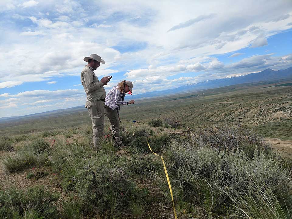
We employ a team experienced in a variety of regulatory and non-regulatory site assessments including; Phase I ESA, National Pollutant Discharge Elimination Systems, Storm Water Pollution Protection Plans, baseline and trend monitoring and soil descriptions.
POST-DISTURBANCE MONITORING
Our team specializes in post-disturbance study design (air, water, soil and vegetation) and implementation. Based upon defensible science, our monitoring plans use the latest technology in their implementation.
MONITOR VEGETATION TRENDS
Whether it is for regulatory compliance or part of another land management goal, our team is equipped with the knowledge and tools to accurately identify vegetation trends at nearly any scale. We utilize the latest data collection and geospatial technology to provide accurate and near real time reporting.

IMPROVED DATA COLLECTION
The latest protocols for vegetation monitoring allow for improved data collection. EcoPoint can tailor your monitoring program to meet your regulatory and compliance requirements. Your operations will be empowered. EcoPoint’s innovative use of technology combined with advanced protocols provides real-time transparency for your actionable and defensible monitoring data.


