Geospatial Technologies & Solutions
A leader in geospatial technologies.
GEOSPATIAL (GIS) TECHNOLOGIES & SOLUTIONS
A leader in geospatial technologies, EcoPoint ensures your investment in digital infrastructure is secure and usable throughout your organization. There are no hidden fees or double charging for access to your data. Whether stored on EcoPoint’s internal data systems or your own digital infrastructure, our system ensures long-term accessibility and security of your data.
WHY ADOPT A GIS-CENTRIC APPROACH?
- Transparency, efficiency, and access to real-time, on-the-ground conditions.
- Targeting and monitoring of specific management objectives.
- Efficiency in planning, management, and decision making.
CLOUD GIS BENEFITS
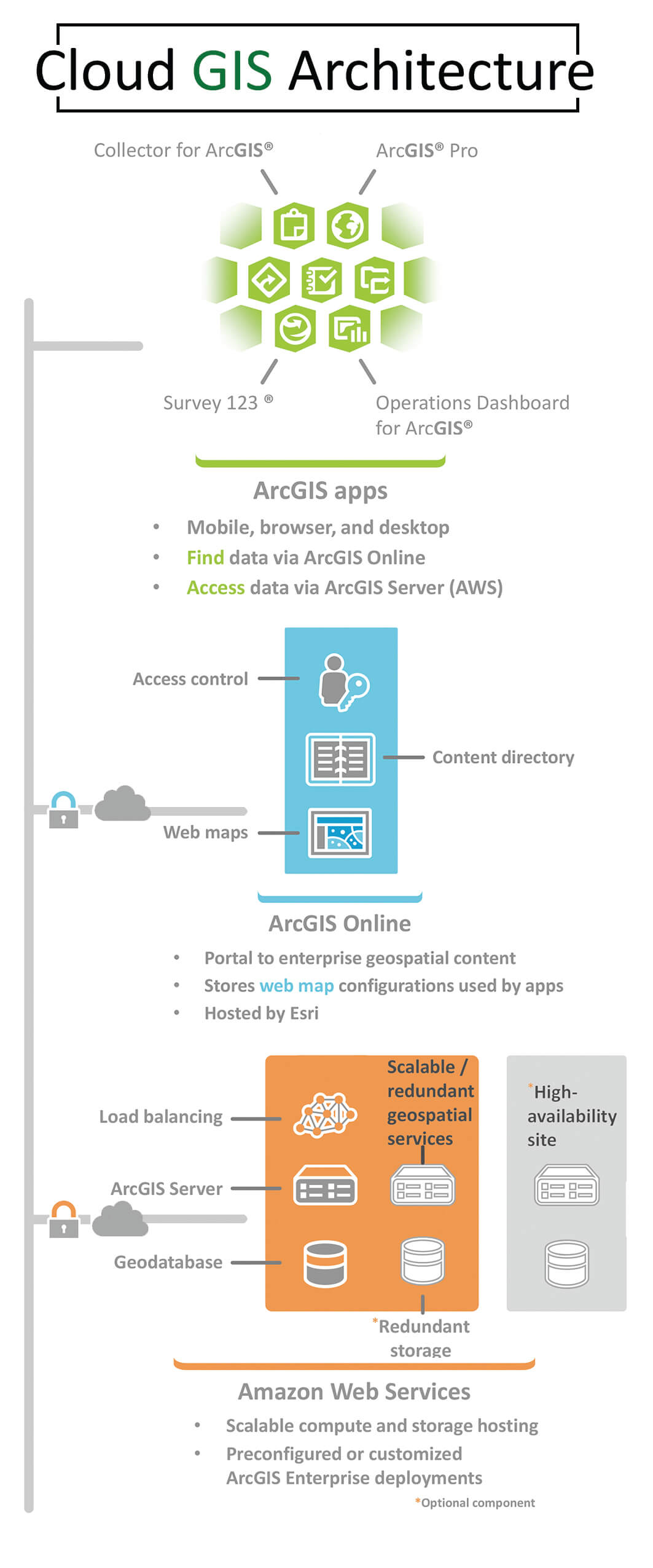
- Accessible from anywhere- mobile, web, or desktop apps; online or offline
- Industry leading reliable hosting- Esri & Amazon
- Secure, scalable, and stable
GEOSPATIAL SERVICES
EcoPoint specializes in solving complex ecological problems through the innovative use of GIS.
Geospatial (GIS) Consulting Services
- Enterprise Geospatial Development
- System Architecture
- Process Automation
- Geodatabase Development and Planning
- Suggested Vegetation Management Video Link
- Strategic Planning
GIS Database Management
- Spatially Explicit Documentation
GIS Field Mobility
- Geospatial Data Collection
- Spatial Analysis and GIS Modeling
- GIS Mapping and Visualization
Geospatial Solutions

WHAT WE DO
With industry leading hosting from Esri, and Amazon, EcoPoint can provide a cloud GIS solution to meet your mobile, web, or desktop GIS needs. EcoPoint ensures your GIS is secure, scalable, and stable. Contact us today to plan your customized GIS solution deployment. Specialized field data collections solutions for every industry’s needs. Whether performing high volume rapid data collection or detailed site-specific collection routines, EcoPoint can deploy the right data collection tools to meet your company’s specific needs.
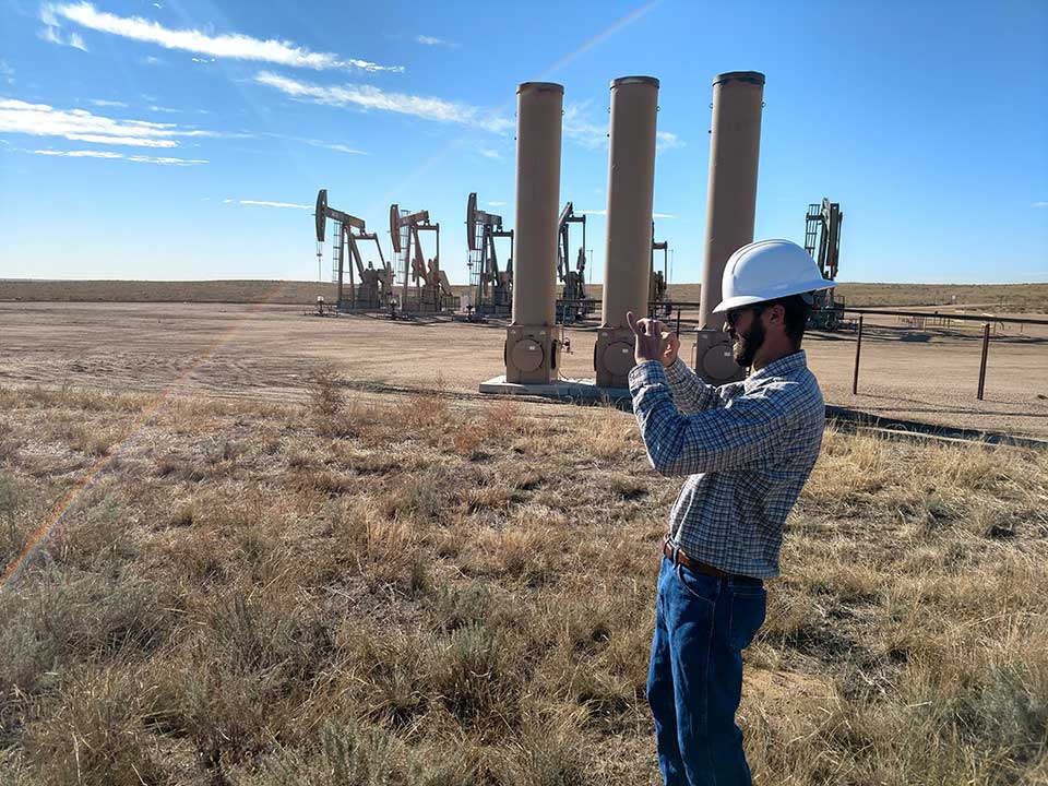
Empower your team. EcoPoint has deployed specialized geospatial solutions for a variety of industries from agriculture to oil and gas. We understand GIS and can ensure your organization takes advantage of the latest advancements in GIS technology. Mission critical analysis and accessibility. With technological advancements there is no need to wait for reports and analysis. Contact us today to find out how we can provide real-time data access, reporting and analysis.
FIELD DATA COLLECTION SERVICES
At our core we are a technologically advanced field data collection company. We offer customized, fully integrated data collection services with real-time data access, analysis and reporting. Our fast and accurate data collection services, mean extraordinary cost efficiency for your data collection projects.
MOBILE FIELD DATA COLLECTION SOLUTIONS
If you prefer to keep your field data collection in-house, we offer mobile solutions to meet the needs of any project. From hardware and customized software to fully integrated geospatial information systems, we provide the data collection solution that is right for you.
ENTERPRISE GIS SOLUTIONS
EcoPoint specializes in the development and deployment of geospatial solutions. EcoPoint, an Esri partner, can help organizations of any size in deploying specialized GIS solutions. We can assist your organization in deploying GIS solutions that are accessible from anywhere, on any device, with industry leading availability, performance, and scalability.


PARTNERED WITH ESRI & JUNIPER SYSTEMS
EcoPoint is a business partner with Esri and Juniper Systems, who are both leaders in the geospatial technology industry.


